
Bathymetric Survey
A Bathymetric Survey is a specialized hydrographic investigation conducted to determine the underwater topography, depth profile, and morphological characteristics of water bodies such as rivers, lakes, reservoirs, canals, harbours, and coastal zones. The survey provides precise measurements of water depth, bed levels, and seabed or riverbed features, which are essential for hydraulic and marine engineering applications.
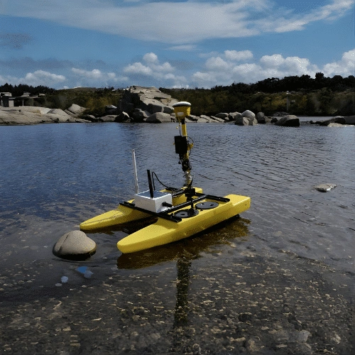
The survey is performed using echo sounders or multi-beam sonar systems integrated with GPS/GNSS positioning to capture accurate horizontal and vertical data. Advanced techniques may also include side-scan sonar and sub-bottom profiling to identify sediment layers, obstructions, scour zones, and underwater structures.
Bathymetric survey data are utilized for:
- Design and assessment of bridges, ports, jetties, dams, and hydraulic structures
- Evaluation of river training works, dredging requirements, and sedimentation patterns
- Navigation channel planning and safety analysis
- Flood modeling and hydraulic studies
- Monitoring of reservoir capacity and morphological changes
By providing high-resolution underwater terrain data, bathymetric surveys support safe design, operational efficiency, and sustainable management of water-related infrastructure projects.